IVRESS/NG-NRMM
IVRESS/NG-NRMM (Next-Generation NATO Reference Mobility Model) uses IVRESS/GroundVehicle along with a stochastic mobility expert system to generate geographic mobility maps for a given ground vehicle and area of operation. The mobility maps are used in military mission planning to find the optimum vehicle path to complete the mission and minimize the possibility of mission failure due to vehicle mobility issues (e.g. vehicle getting stuck, vehicle running out of fuel, or vehicle cannot complete the mission in the specified time due to low speed). The mobility maps include omni-directional and directional maps of vehicle mobility measures such as speed-made-good, fuel efficiency, and occupants absorbed vibration power.
The input to IVRESS/NG-NRMM consist of the terrain GIS (Geographic Information System) data, soil and vegetation mechanical properties, and the ground vehicle data. IVRESS/GroundVehicle is used to predict the dynamic response of the vehicle over many (thousands) of terrain variations including slope, roughness, obstacles, soil properties, and vegetation properties on the specified terrain. The stochastic mobility expert system uses those simulation as a basis to generate the stochastic vehicle mobility maps.

IVRESS/NG-NRMM Features
-
Simulations can be performed on:
-
Hard (undeformable) polygonal or Cartesian grid terrains.
-
Deformable soft-soil Cartesian grid terrains (NG-NRMM height-field simple terramechanics).
-
Deformable soft-soil DEM terrain (NG-NRMM complex terramechanics).
-
Liquid/water (SPH) covered hard on deformable terrain.
-
-
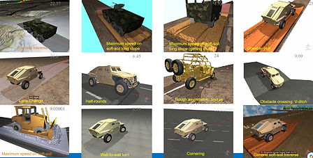
Vehicle simulation events (for NG-NRMM model calibration & Validation, and mobility mapping):
-
Maximum speed / acceleration on long/side slopes.
-
Lane change / obstacle avoidance.
-
Going over obstacles such as: half-rounds, steps, ditches, etc.
-
Going over rough 2D/3D courses: occupants absorbed vibration power, NVH, suspension vibrations, track vibrations, components fatigue, etc.
-
General traverse
-
Stability on slopes
-
Drawbar-pull
-
Wall-to-wall turn
-
Cornering
-
Braking
-
-
Tire models: Finite Element tire; Lumped Pacejka tire
-
Track models: single/double pin segmented tracks; rubber belt tracks
-
Legged robots
-
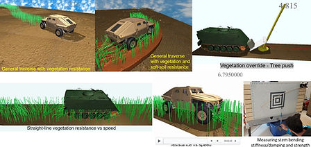
Vegetation stems and trees models
-
Simple and complex terramechanics soil models
-
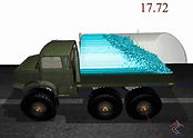
Liquid sloshing and water fording (liquids modeled using SPH)
-
Co-simulation/FMI for: drive train, active suspension, etc.
-
User-friendly template / spreadsheet user interface
-
GIS input maps
-
Stochastic mobility mapping expert system for generating the output vehicle mobility maps.